
PONOKA -- Ponoka residents will have until Wednesday to share their feedback on the province's new local flood study.
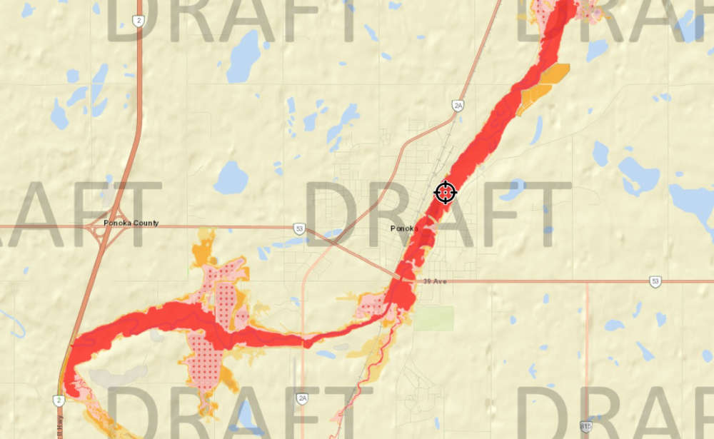
The study for Ponoka identifies flood hazards along 19 km of the Battle River and five km of an unnamed tributary through Ponoka and Ponoka County. The study started in 2023, and both technical work and local authority review were completed in 2025.
It includes a main report that documents the collection of survey and base data, summarizes the hydrology assessment, describes the hydraulic model creation and calibration process, presents the flood modelling results used to create flood maps, illustrates the information used to define the floodway and flood fringe, and includes the flood hazard maps.
According to the Alberta government, the goal of the new Ponoka flood study is to enhance public safety, protect communities from future damage, and provide local governments with the accurate, up-to-date data required to plan safer developments.
One of Ponoka's worst floods came back in the year 1990 when the Battle River overflowed into the east side of 50th Street. This resulted in water filling the river valley all the way into Riverside. This resulted in extensive damage in the area. Another serious flood was noted in 1948 when rapidly melting snowpack resulted in widespread inundation and property damage.
When the draft flood study is finalized, it will replace the older Ponoka flood study, which was completed in 1994, and expand coverage. The new study will replace 8 km of older mapping and add 16 km of new mapping through areas never mapped before. The current public engagement process focuses on the draft flood inundation maps, which show areas at risk for different-sized floods to help with emergency response, and the draft flood hazard maps, which define floodway and flood fringe areas to help with long-term planning
The potential effects of climate change were assessed as part of the hydrology assessment, according to the province. Residents who would like to learn more about the new flood maps for Ponoka and participate in a provincial survey can head to https://www.alberta.ca/ponoka-flood-study-engagement.
 Seasons Ponoka marks International Day of Older Persons
 New mobile welding lab launched for indigenous students
 Charges laid following shooting in Maskwacis on Sept. 22
 Ponoka to host Halloween drive-in movie on Oct. 30
 Ponoka RCMP Report, Sept 1 - Sept 30